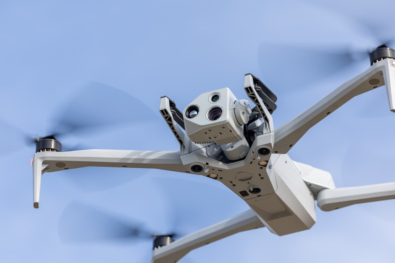
Skydio X10D
DRONE AS FIRST RESPONDER (DFR)
Get frontline visibility 24/7 with a Drone as First Responder program. Combine X10's best-in-class autonomous flight, Remote Flight Deck, and pilot missions to get extra eyes for any mission.
Details you've got to see to believe.
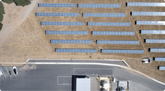
Put the entire scene in focus for mi-distance shots.
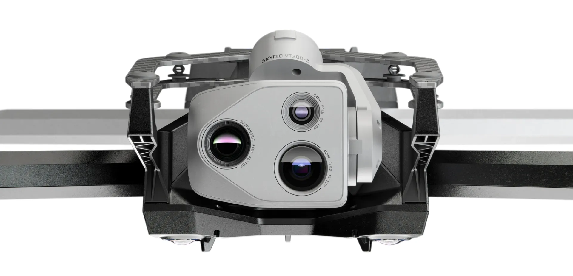
Taken with the VT300-Z. Narrow, camera module 46 mm eq., f/1.8, 64 MP, 50° field of view
FOCUS ON ENTIRE SCREEN
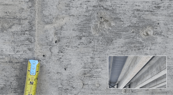
Detect a 0.1 mm crack in concrete under a bridge, in low light.
Taken with the VT300-L. 1" Wide module & onboard light. 20 mm eq., f/1.95, 50 MP, 93° field of view.
DETECT TO 0,1MM
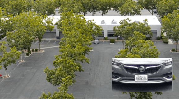
Read license plate from 800 feet.
Taken with the VT300-Z. Telephoto lens 190 mm, f/2.2, 48 MP, 13° field of view
READ LICENSE PLATE
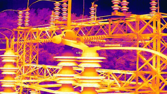
Unrivaled thermal imaging.
Skydio X10 is the first drone ever to integrate a FLIR Boson+ sensor, delivering the highest quality thermal imaging.
Fly with ease.
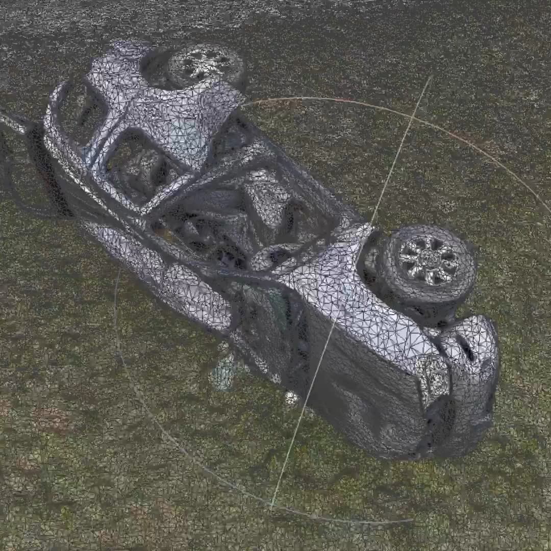
Navigate the most complex missions confidently, even in GPS-denied or high EMI environments. With superior AI flight assistance and obstacle avoidance, you no need to hire a specialist to get the job done, whether you're in the field with your drone, or piloting from a hundred miles away.
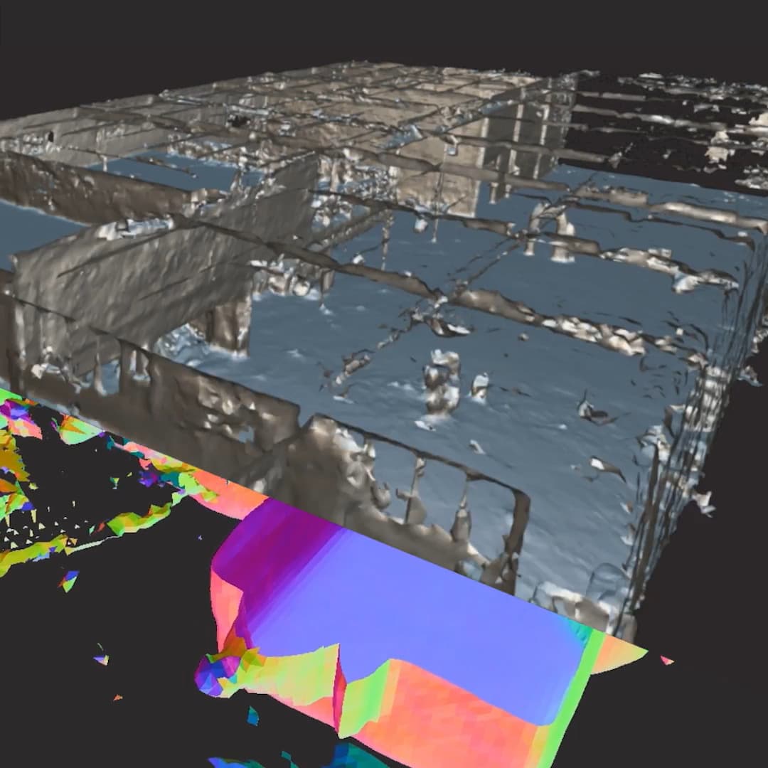
Automate complex missions.
Complete targeted inspections automatically, with a new Spatial AI Engine that senses and understands what you're scanning. Efficiently build 2D maps and 3D models onboard, in real time. Or export data to Pix4D, Bentley iTwin Capture, DroneDeploy, or ESRI SiteScan.
Get smarter over time.
Skydio X10 is loaded with the computing capacity for its AI data capture and synthesis capabilities to grow over time.
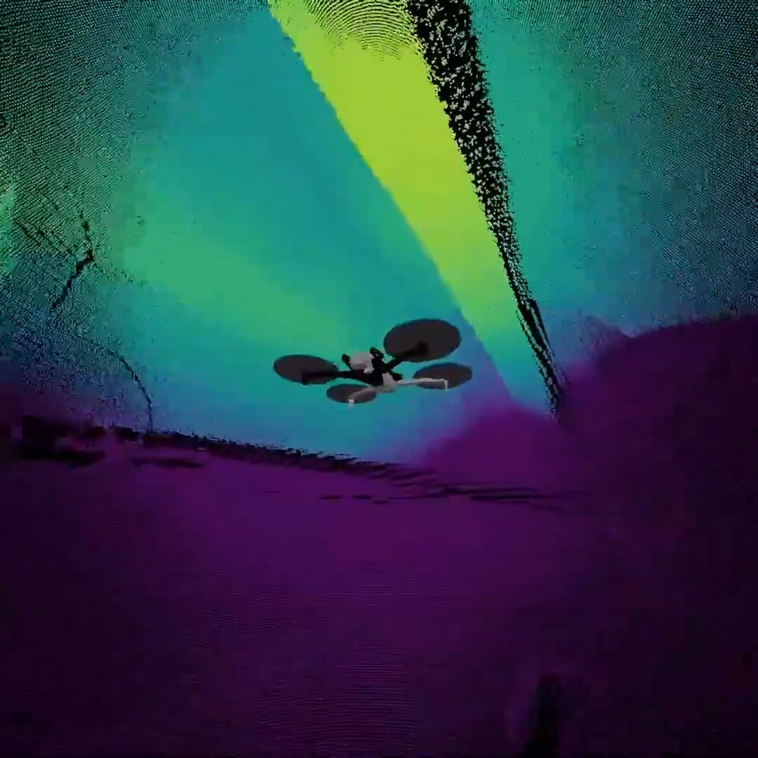
Autonomous flight at night? You're not dreaming.
IR Nav Cam and Illuminator. Using NightSense, the X10D averts visibility at night.